Originally published at: Houston’s forecast keeps evolving, and we explain why there’s so much uncertainty – Space City Weather
In brief: We’ve had a lot of questions about weather for this upcoming weekend, and the forecast keeps changing. We explain why. At this point there appears to be a solid chance of rain on Saturday and sunnier and hotter conditions on Sunday. But no promises!
Why is the forecast uncertain?
There are some patterns, such as high pressure in the summer, that allow us to confidently forecast conditions in Houston out to 10 days, at least. Similarly, in the winter-time, we can pretty clearly see when cold fronts are going to arrive and then depart the region out a week or more. However there are other times when the overall picture is murkier, and this week is one of them.
At present, generally, we have low pressure overhead or nearby, which is conducive to stormier patterns. We also have ample moisture at the surface, as you can tell if you step outside and feel the humidity. However this is not a slam dunk for precipitation, as we have pockets of drier air higher up in the atmosphere. Moreover there is a capping inversion (we discussed this more in our recent Q&A) that could inhibit what would otherwise be a stormy afternoon today.
If you add this all up you have a low-confidence forecast and a frustrated meteorologist.
Wednesday
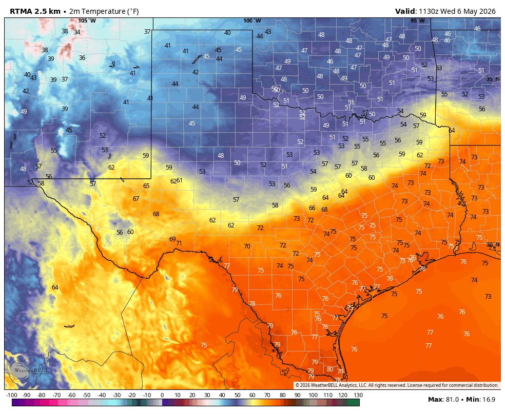
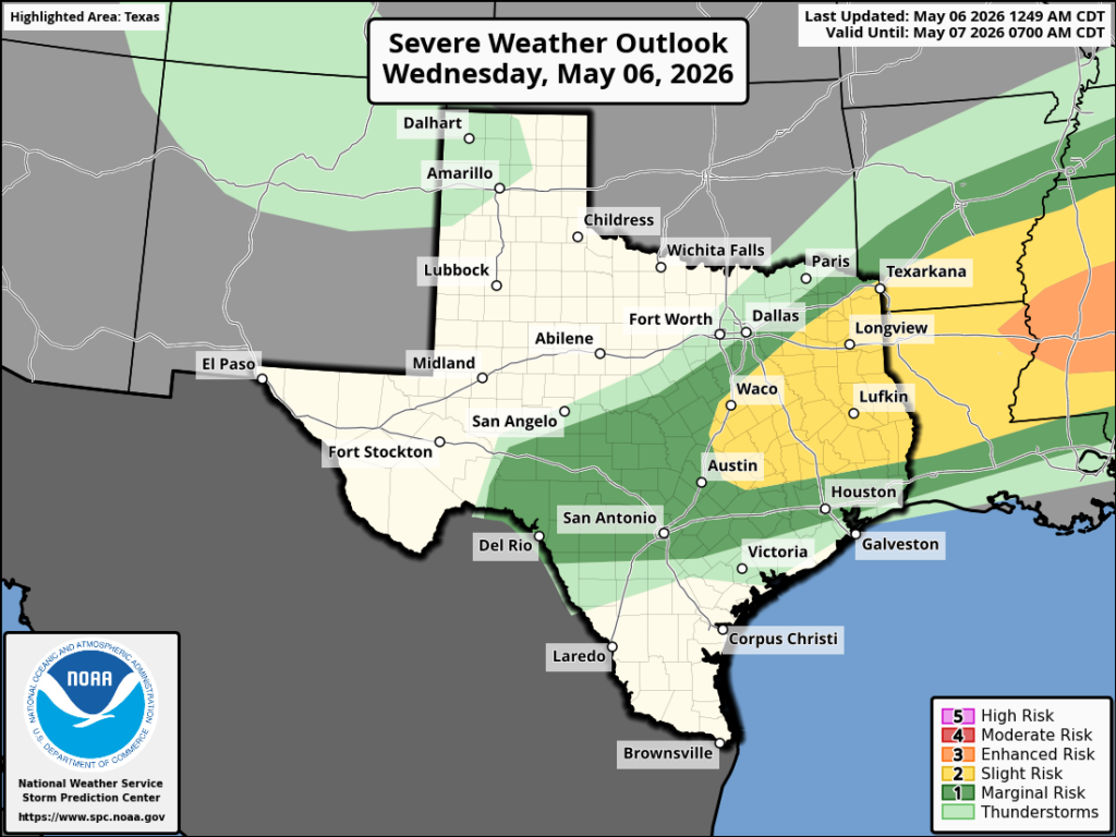
So … today. We’re starting out warm and muggy, and we’re going to get warmer, as high temperatures climb into the upper 80s even with mostly cloudy skies. There will be a slight, perhaps 20 or 30 percent, chance of showers throughout the daytime across the region. By this afternoon, ahead of a front, we may see some stronger thunderstorms. Emphasis on maybe. If the cap holds, there won’t be much. If it breaks, we could see severe weather with hail, damaging winds, and possibly a tornado. I expect the capping inversion to win out, but be prepared for the possibility of inclement weather this afternoon or evening, especially in Montgomery County and points north. A weak front pushes into the area this evening, bringing somewhat drier air after midnight. Lows will drop to around 70 degrees.
Thursday
Whereas Thursday once looked to be fairly rainy, it now does not. I’d say there is maybe a 20 percent chance of mostly light showers, with high temperatures in the vicinity of 80 degrees and plenty of cloud cover. Lows on Thursday night will drop into the upper 60s, with an ongoing chance of light rain.
Friday and Saturday
A low pressure system moves into the area on Friday, and this probably will serve as a focus for widespread rainfall. But again, there is some real uncertainty here. I could see most of the region picking up about 1 inch of rain, or I could see a scenario in which showers and thunderstorms are much more scattered. This system hangs around overnight and into Saturday, so there will be a healthy chance of rain overnight and for much of the day on Saturday. Again, these showers could be fairly scattered, or more widespread. The chance of severe weather is pretty low. Highs on Friday will be about 80 degrees, and by Saturday we’ll be into the mid-80s.
Sunday
The chance of showers does not go away entirely on Sunday, but it is much reduced. I think we’re also going to see a real chance for some sunshine on Sunday afternoon, so this should allow high temperatures to pop up into the upper 80s.
Next week
Monday looks pretty hot as well, but another weak front arrives on Tuesday (probably) to slightly cool us down and bring a modicum of drier air. Most of next week, at least before the weekend, should be rain-free.