Originally published at: Houston’s stormy pattern continues for a few more days, but hotter weather is on the horizon – Space City Weather
In brief: We discuss the high levels of atmospheric moisture in today’s post, and explain how widespread showers and thunderstorms are likely through Friday. Some storms may persist into the weekend, but next week looks likely to be hotter and drier.
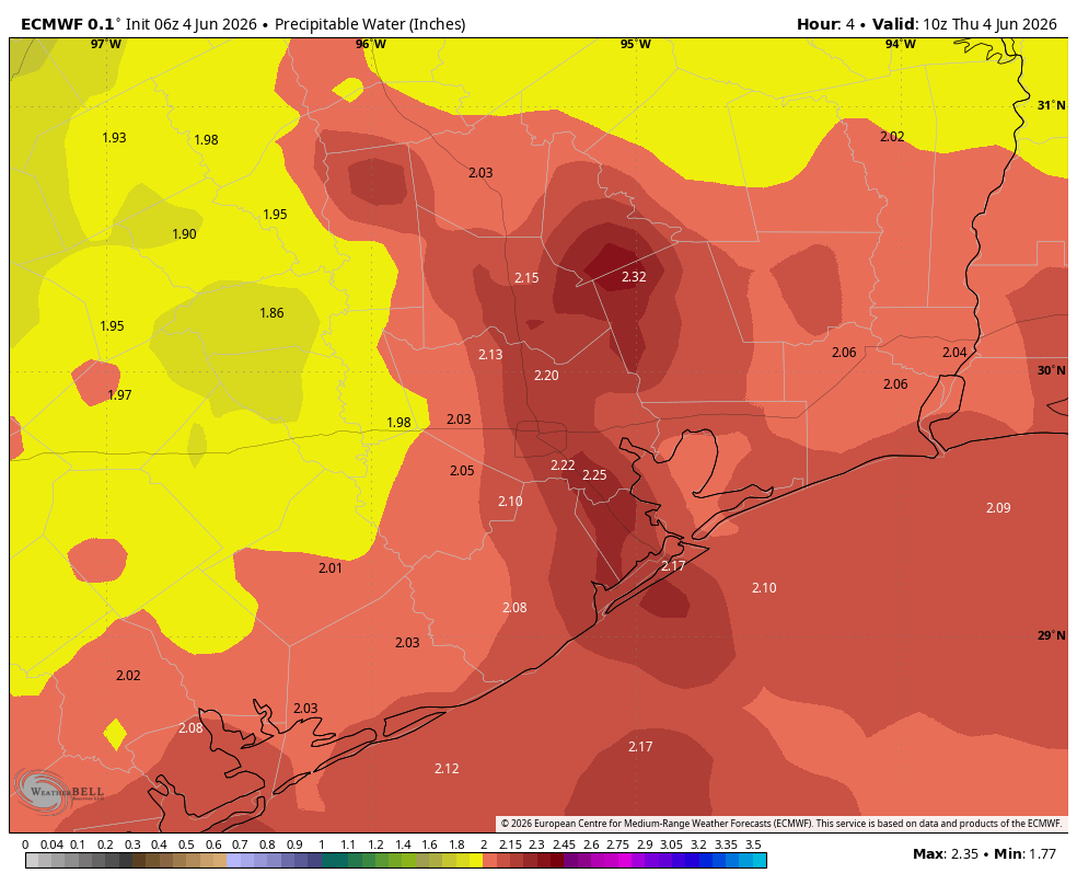
Plentiful atmospheric moisture
Atmospheric moisture continues to surge in from the Gulf of Mexico, and in the absence of high pressure this is allowing for ongoing showers and thunderstorms across the region. We measure atmospheric moisture levels by “precipitable water” which basically means if you took a column of atmosphere from the surface all the way to outer space, how much water is there? Generally speaking 2 inches, or more, is very favorable for rainfall. This morning we are seeing 2 to 2.25 inches across much of the region, and levels will remain high for several days more.
We are not too concerned about flooding because the storms remain fairly progressive, in that they are moving through with a decent pace, and local stream and floodways continue to drain well. Nevertheless we’ll continue to keep an eye on things.
Thursday
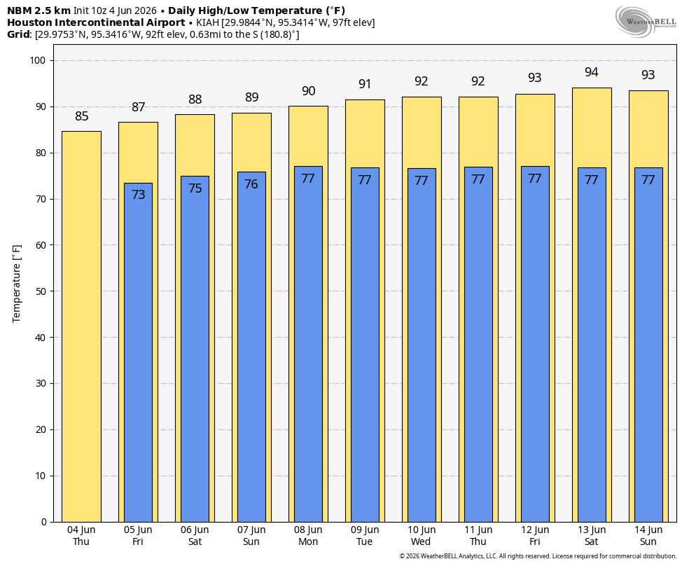
We are likely to see widespread showers and thunderstorms today, with highly variable accumulations from low tenths of an inch to perhaps some locations seeing as much as 2 inches. This will help moderate high temperatures this afternoon. Areas with clouds and rains will likely top out in the low- to mid-80s, whereas areas that see sunshine for a couple of hours this afternoon may push 90 degrees. Some rain chances will continue overnight, with lows falling into the mid-70s.
Friday
This is likely to be a similar day to Thursday, with the likelihood of widespread showers and thunderstorms across the region. It’s possible that we see a little more sunshine on Friday afternoon, in which case high temperatures for most locations will reach the upper 80s. We will continue to see plenty of humidity and warm nights.
Saturday and Sunday
So what of the weekend? What of it, indeed. I think we’ll see diminution in coverage by showers and thunderstorms, but most of our available guidance indicates we’ll still see some activity. In addition, the precipitable water levels discussed above will remain fairly healthy. Accordingly I expect about a 40 percent chance of showers and thunderstorms each day—but given some lingering uncertainty we may still need to adjust this forecast. Highs on both days should be around 90 degrees, with plenty of humidity. It certainly won’t rain all day every day.
Next weekend
It looks like high pressure may try to encroach from the east-southeast next week, and if it does this should lead to sunnier weather, highs in the low-90s, and rain chances falling into the 10 to 20 percent range for much of next week. That’s what things look like today, anyway. As always, we’ll have to see.