Originally published at: Thursday was Houston’s hottest day of 2026 and now the humidity is returning – Space City Weather
In brief: After the hottest day of 2026 in Houston, we expect a quiet, less hot but more humid weekend. Rain chances then pick up next week with potentially locally heavy rainfall in spots by midweek.
Yesterday was our hottest day of the year in Houston, as we officially hit 91 degrees at Bush Airport. Lest anyone wonder if IAH is too overcooked, a CenterPoint sensor adjacent to the airport hit 90 degrees, so the answer is probably not. Hobby Airport also hit 91 degrees. That’s our 5th 90 degree day of the year. Early summer is here.
Today
We have a shot at pushing 91 again today, though I think we may come up just a tinge short. Dewpoints and thus humidity are a bit higher today.
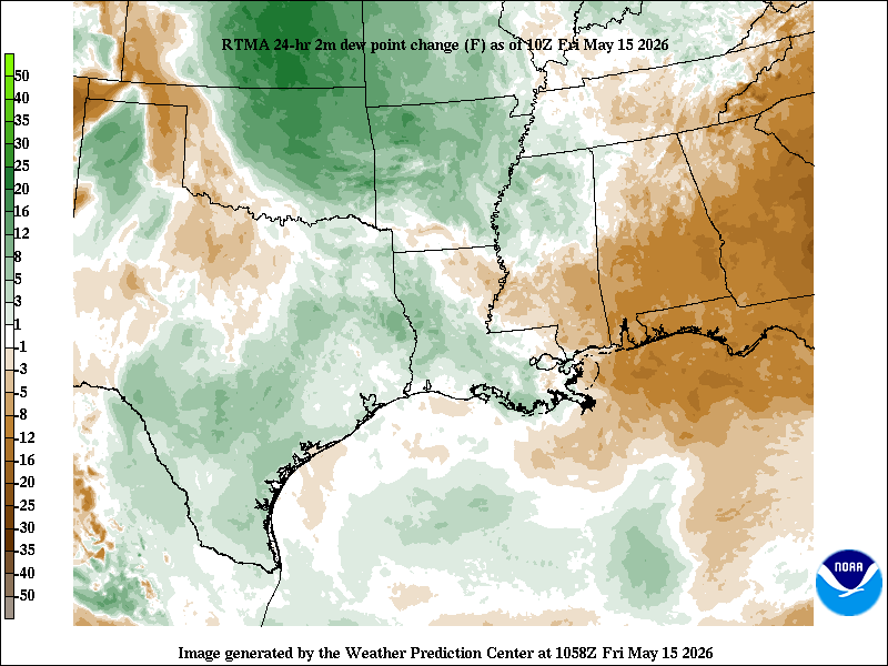
We also have a few extra clouds streaming through the area today. Either way, we are quibbling. It should feel fairly similar today to yesterday.
Weekend
Saturday looks fine. Sunday could see an isolated shower but nothing that would significantly disrupt your plans. You will notice the breeze this weekend. Onshore winds around 15 to 20 mph with gusts as high as 30 mph are possible on both weekend days as more humid air continues to rush ashore. High temperatures will probably come up short of 90 degrees, with mostly upper-80s expected. Cloud cover will be noticeable on both days, along with breaks of sunshine.
Next week
Expect a more active weather week next week. A pretty substantial plume of moisture in the atmosphere is going to extend from Texas, across the western Gulf, and into Central America. Some of this moisture plume actually extends back into the eastern Pacific too. So, we will have plentiful moisture in place to support potentially heavy rainfall in spots.
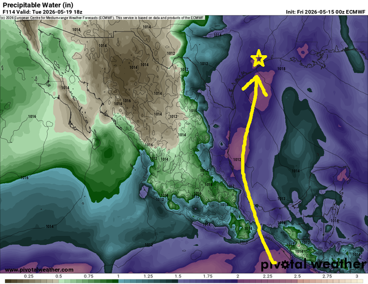
The question we can’t answer this far out is where the triggering will end up. Will it be mainly in interior Texas? Louisiana? Here in Southeast Texas? We don’t know just yet, but there are plenty of signals in the modeling that 1 to 2 inches of rain or more will fall next week across the region. Isolated higher amounts would be almost guaranteed in this type of pattern. Bottom line: It’s too early to say exactly who will see the most rain next week, but there is an increasing chance that some parts of the area will receive locally heavy rainfall, especially next Tuesday or Wednesday. More to come on this.
The rain will hold back daytime temperatures a good bit, with highs mainly in the 80s but the moisture and clouds will hold lows in the mid to upper-70s. May the foggy glasses when you step out of the car commence.
