Originally published at: Less heat as coverage of daily downpours in Houston increases the next few days – Space City Weather
In brief: Additional shower chances over more of the Houston area will build up this weekend as we get a slight reprieve from high summer temperatures. After this weekend, we head back toward the frying pan with a very classic August heat wave likely by next weekend.
After Wednesday’s dud of a day in terms of rain, yesterday was fruitful for parts of the Houston area. Just west of Sugar Land toward New Territory saw 2 to 4 inches of rain. Rosenberg was on the board around 2 to 3 inches. The south side of Pearland over to Friendswood saw a solid 1 to 3 inches. And the narrow area between Ellington Field and Johnson Space Center saw about 2 inches and change. Some other areas saw less rain, albeit a fair bit in spots.
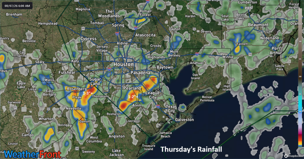
Congrats to our winners!
Today
For most places, today will just be another sultry August day with highs in the mid to perhaps upper 90s. But much like yesterday, there will be at least a few spots that get cooling downpours. As is often the case in summer, the end result could be a quick 1 to 4 inches in any given location, while most folks see nada.
Weekend thru Monday
The next few days after today will have better rain chances over a wider chunk of the area than there have been lately. While some areas have indeed cashed in, many have not. This weekend into Monday will be a good opportunity to get some other places on the rainfall board. As a result of higher coverage of storms and downpours, highs will be in the mid-90s at best, with a few spots maybe not even getting much past 90 degrees if the rains can hit earlier in the day.
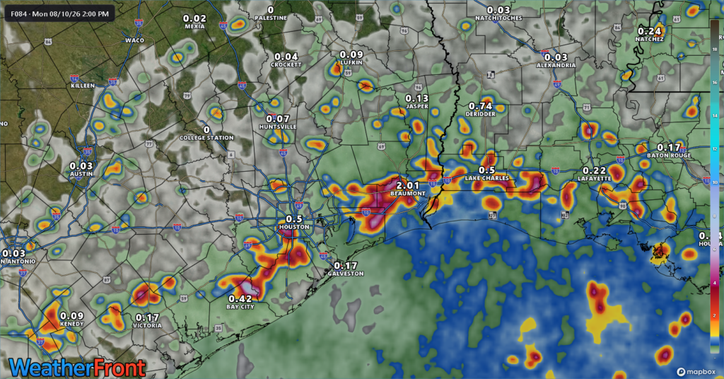
Hopefully everyone can participate at least a little.
Tuesday and Wednesday
These will be the transition days out of the weekend pattern. Look for highs to slowly build back more consistently into the mid-90s or closer to 96 or 97 degrees. Rain chances will begin to gradually slump back toward where they’ve been this week, meaning fewer folks will cash in on the rainfall lotto.
Beyond midweek
The pattern looks to be changing back to a more standard August heat wave setup for East Texas. This will mean daily highs in the upper-90s to near 100 degrees, with lows near 80 degrees. And rain chances, while not zero will be at a premium. Nothing remarkable or severe by Houston standards but very August-like, and it will likely prompt at least a few Heat Advisories heading toward next weekend.
We leave you today with…
A message from Reliant
Don’t get caught in the dark. When the power goes out, your refrigerator, air conditioning, internet services, medical devices, and home security system can all be affected. Through a special partnership with Quality Home Products of Texas, Reliant customers can claim $1,000 off plus one year of free monitoring and preventive maintenance on installed air-cooled Kohler generators up to 26 kW*. This offer is available to eligible Reliant customers only and expires on September 30, 2026. Learn more here.
* Additional terms and conditions apply; contact Quality Home Products of Texas for details.



