This weekend's heat reprieve isn't much, but given what's ahead we should appreciate it all the same

Originally published at: This weekend’s heat reprieve isn’t much, but given what’s ahead we should appreciate it all the same – Space City Weather

In brief: In today’s post we discuss the pattern that will bring slightly cooler weather and improved rain chances over the several days. Monday continues to look like the day when the region will see its most widespread rainfall, but even then many will probably be disappointed. Major heat looms on the horizon.
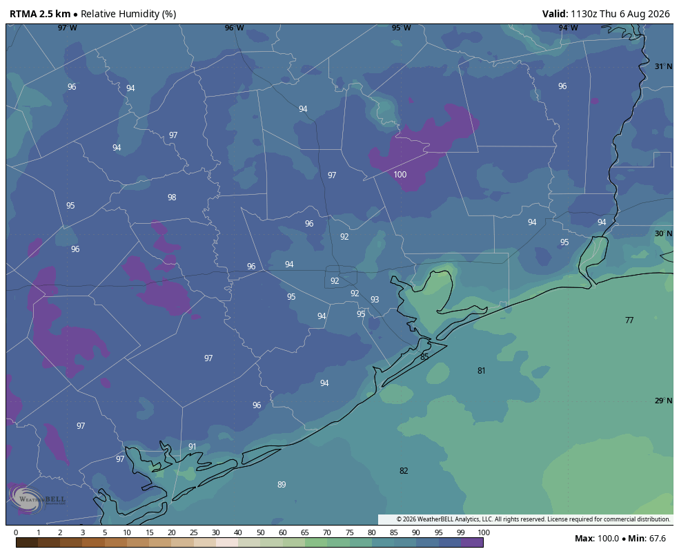

Quick August status update

We are now 16 percent of the way through August, if you’re keeping track. And I am. The good news is that we are going to see a bit of a break in temperatures over the weekend, and possibly even some scattered rain showers as high pressure relents a little bit. The bad news is that the latter half of next week (and beyond?) still appears likely to see the return of a stout high, and a period of very warm temperatures.

Thursday

This will be another day that in some ways will similar to what we’ve experienced so far this week: sunny, with high temperatures in the upper-90s for most inland areas. Coastal locations will see daytime temperatures that are a few degrees lower, but it’s going to be hot and humid everywhere. However, one change is that conditions are a little more favorable for the development of showers and thunderstorms this afternoon. Most of us probably won’t see any rain, but localized downpours may produce 1 inch or more. These showers are most likely to develop during the afternoon and early evening hours, with peak heating.

Friday, Saturday, and Sunday

Highs over the weekend will be a few degrees lower, perhaps in the mid-90s for most of Houston. Overnight lows remain warm and muggy. We are likely to see mostly sunny skies most of the time, but each day will likely have a roughly 30 percent chance of afternoon and evening showers and thunderstorms along the sea breeze. These will be hit or miss, again, so expect the potential for some localized downpours.

Monday

This will probably be the “coolest” day of the period, with partly cloudy skies and highs perhaps only reaching the lower 90s for most locations. With high pressure likely at its weakest, we have a chance of more widespread showers on Monday, but just how widespread remains a question. We shall see.
Rest of next week

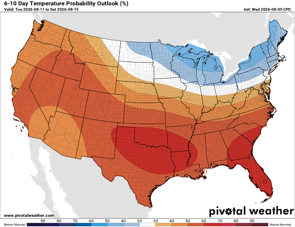
After Monday or Tuesday, our temperatures are back on the upswing. Highs will be in the mid-90s, then the upper-90s, and eventually possibly even back into the 100s. Rain chances will correspondingly decline. This very hot pattern persists at least into next weekend. The only note of hope that I can offer you is that, by that point, August will be half over.

3 Likes

Thank you sir. A valiant attempt to provide hope here. When morning conditions are the same day after day after day…

1 Like

I’ve said it a few times in comments, but really, this summer overall hasn’t been horrific. It’s summer, it’s going to be hot and humid. But it hasn’t been months, even really weeks of non stop oppressiveness. And, with the hopium that this post gives, once we get through next week, August will be half over. No major hurricanes on the horizon, we’re not in drought. Things are good.

4 Likes

Gotta agree with @CraigHarmann — it’s definitely not as bad as it could be. I think the part I like least is the warm nights, where the AC struggles to haul the bedroom down to something in the lower 70s so I can sleep. Our home hvac is about 12 years old and it’s fine for most of the year, but for the past few years it’s been having a harder and harder time during the long Aug-Sept stretch of >80F nights.

I genuinely don’t understand how people lived in this latitude without air conditioning. I could probably deal with the daytime, but being hot at night is just unlivable.

5 Likes

I felt every bit of the humidity on the morning walk. Wondering why I don’t buy or rent a cabin in Northern Michigan for the summer.

2 Likes

With all the recent discourse around the increased cloud cover over highways and the speculation that it’s due to increased condensation nuclei, I find myself wondering if precipitation also tends to fall in the vicinity of highways. I feel like it wouldn’t necessarily be apparent when we have a broad rainfall pattern or a frontal passage, but it might be observable when we have sparser rain coverage with these bullseyes of precipitation like we see with summer afternoon storms.

2 Likes

It definitely is observable with scattered summer storms that fire up primarily over big cities and the Phillips chemical plant that I live near. There has been numerous occasions where I will see a storm fire up right over the plant but nowhere else, or the storm develops near the plant and intensifies over it. It’s the same for the big city as well. It’s the extra heat that these refineries and cities give off that also helps fuel these scattered storms. I’m not sure about roadways though.

2 Likes

I don’t want to dampen the mood here, but temps in the 90s to 100s is basically every summer here on the gulf coast. Just have to get through it and hope you get timely rains to offset drought.

People in the old days without ac were able to do it because the body was more adjusted and they opened windows with screens on them to let air in. Also they never experienced ac so they didn’t know what life was like with it. Trying to go back without ac…wouldn’t be able to handle it. Plus there was no urban heat islands like there is today with all this population and concrete jungle going on.

Labor day is September 7th, expect heat all the way past that point. We are in dog days of summer now and this is how it has been here on the gulf coast.

3 Likes

When Canada continues to burn down, the smoke up there will probably kill you faster then the heat and humidity does here.

1 Like

I’ll be in Minnesota in a couple of years. Looking forward to it.

1 Like

Also the South didn’t really take off in population growth until AC was invented.

Had some rains out in Manvel and looks like Pearland/Friendswood area is getting some rains as well.

Even if there’s no storms, the break from the sunshine with heavy clouds really helps. Oh I just saw some lightning

Looked promising for awhile, but it was not to be.

Do you have a recommended site to view hourly forecasts for WBGT (Wet Bulb Globe Temp) values for the Houston area?

1 Like

Yeah, that was disappointing.

This topic was automatically closed after 24 hours. New replies are no longer allowed.