Originally published at: Houston’s weather to turn warm and muggy for quite awhile now – Space City Weather
In brief: In today’s post we discuss how Houston is about to settle into a persistently warm and muggy pattern for at least the next week, and probably longer. We also take a look at rain chances for Friday and the weekend, which are trending down.
Sultry April nights
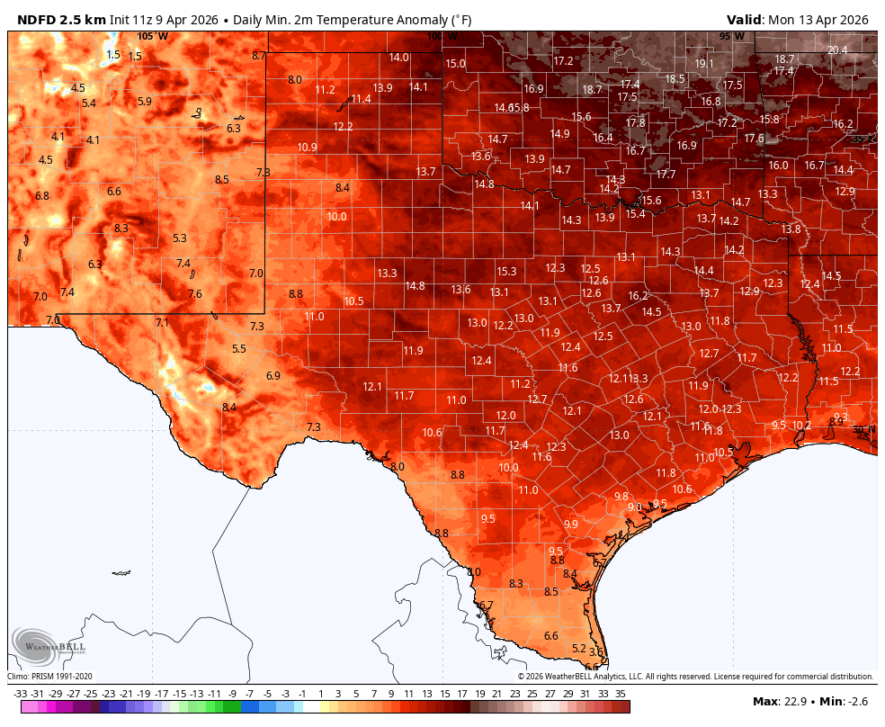
Our weather is about to feel more like late May than early April. Daytime temperatures for the next week, at least, won’t be too abnormally warm, generally slotting into the 80 to 85 degree range. But our nights will be anomalously warm for sure. Typically we see lows down around 60 degrees for this time of year. But after this morning, with a low of 61 degrees at Bush Intercontinental Airport, our nights will be in the vicinity of 70 degrees, climbing potentially to the lower 70s by this weekend and beyond. This is indicative of a warm onshore flow and increasing moisture levels, and indeed there will be plenty of humidity. Will there be enough moisture for widespread showers? We discuss below.
Thursday
Our winds from the east are fairly light this morning, but they will pick up this afternoon, perhaps gusting up to about 20 mph. I expect some clouds, but for much of the afternoon partly to mostly sunny skies should prevail, allowing high temperatures to reach the lower 80s this afternoon. I don’t think we can entirely rule out some rain showers, but right now I would peg chances at about 10 percent, with only some fairly isolated activity. Clouds return tonight, with lows around 70 degrees in Houston, with slightly cooler conditions further inland.
Friday
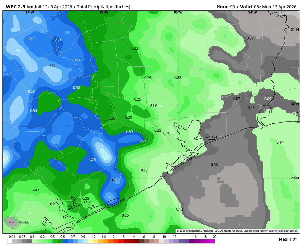
Expect highs of around 80 degrees with mostly cloudy skies. Overall conditions will be favorable for rainfall, but not perfect (I’m watching for some subsidence). In any case I think our region will have about a 50 percent chance of showers, with accumulations of less than 1 inch (and probably considerably less for most of us). Showers are most likely during the daytime hours, and fading during the evening and overnight hours. Expect another warm night.
Saturday and Sunday
The weekend will see continued warm and muggy weather, with highs in the low 80s and partly to mostly cloudy skies. Rain chances for both days are likely on the order of 30 percent, but any rain that falls should not be in the form of sustained showers. Rather, this likely would be in the form of passing showers. Nights remain about 10 degrees above normal.
Next week
Most likely we will see a continued warm and muggy pattern next week, with temperatures perhaps rising to the mid-80s by Wednesday or Thursday. Our atmosphere will remain in a somewhat unsettled state, so we could see some increasing rain chances by the middle of the week, and possibly some severe weather. However, the bulk of this threat looks to remain to the west of us, and I cannot pin down any specific threat just yet. So it’s not something I’d be particularly concerned about right now. As for the region’s next front, I just don’t see any strong signal for that in the next 10 days. I’d very much love to be wrong about that.