A light freeze is possible on Saturday night in Houston

Originally published at: A light freeze is possible on Saturday night in Houston – Space City Weather

In brief: In today’s post we review the region’s average temperature over the first two weeks of the month. We also take a look at a sharp front that may bring a light freeze into the area by Sunday morning, as well as rain chances for later next week.

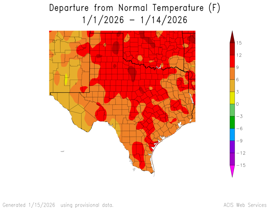
January is nearly half over

Through the first two weeks of January the average temperature was 62.6 degrees in Houston, at Bush Intercontinental Airport. If you’re wondering, that’s 9.5 degrees above the normal level this time of year, and more typical of mid-November. It will be interesting to see where we end up given that we have a couple of days below normal this weekend before somewhat warmer conditions later next week. For what it’s worth, some parts of Texas has been even warmer than this, relative to typical January conditions. Some parts of north Texas have been 12 to 15 degrees above normal for the first two weeks of this month.

Thursday

It feels like a normal January outside this morning, with temperatures falling to about 40 degrees (the usual lower spots, such as Conroe, have fallen into the mid-30s). The good news is that the strong-ish winds from Wednesday afternoon have died down overnight, so there’s not too much of a wind chill about. We’ll see moderate northerly winds throughout the day. Sunny skies will help us warm to about 60 degrees, or just below, later this afternoon. We are going to have a clear and cool night, with lows in the mid-40s in Houston, with slightly cooler conditions for outlying areas.

Friday

With a returning southerly flow temperatures on Friday will push into the lower 70s for most of Houston, with mostly sunny skies. Southwesterly winds may turn a bit gusty, up to 20 mph maybe. A front will arrive to change that, but I think it is unlikely to do so until after sunset on Friday. This will largely be a dry frontal passage, but there may be enough moisture closer to the coast to squeeze out a few showers. I’d only put chances at 10 or 20 percent, and they will pass quickly as the front sweeps through. Lows on Friday night will drop into the mid-40s.

Saturday and Sunday

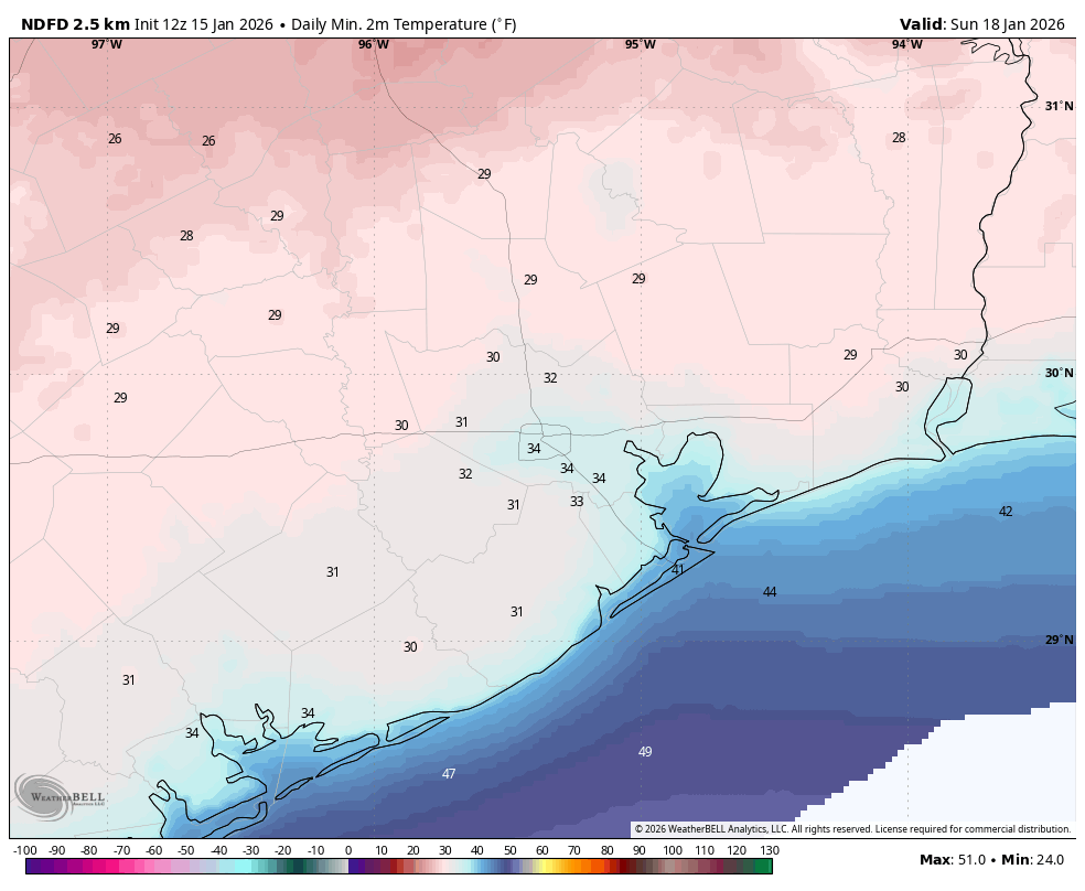
We are going to see plenty of sunshine and cooler air this weekend. Highs on Saturday will likely top out in the mid-50s for most areas, and we could see fairly blustery winds from the north (perhaps gusting to 20 mph or a bit higher). If you have outdoor activities planned keep this in mind, as the wind will definitely add some chill to the air. Lows on Saturday night will bottom out with clear skies and lighter winds. A light freeze is possible in the region, perhaps including urban Houston although I certainly wouldn’t bank on that. Matt will have a better estimate of the freeze line in tomorrow’s post. Highs on Sunday will again be in the upper 50s, although with less wind it should feel a bit warmer. Lows on Sunday night will reach about 40 degrees, with cooler conditions for outlying areas.

Next week

If you’re attending a parade on Monday for M.L.K. Day you can expect fine, mostly sunny weather with highs in the 60s. After this we should see more clouds next week. A weak front is likely to push in Monday night or Tuesday, possibly bringing some rain chances. But then we’re going to see warmer conditions, with highs in the 60s and 70s for the rest of the week. The presence of a coastal low pressure system is likely to bring increased rain chances on Wednesday and Thursday, although this will depend on how far the low progresses inland. But for coastal areas (i.e. south of Interstate 10) that have been really dry in December and January, for now this provides a hopeful signal for some rain. Some sort of front may arrive by next weekend, we’ll have to see.

2 Likes

“O wild West Wind, thou breath of Autumn’s being, Thou, from whose unseen presence the leaves dead Are driven, like ghosts from an enchanter fleeing…” -Percy Bysshe Shelley

One of the rare advisories from the NWS is a “Low Water Advisory”. It almost always happens in the winter after a strong Blue Norther when the Northwest wind blows all the water out of our bays and estuaries. It’s a warning to our mariners to help avoid groundings. Anecdotally it seems to be issued 3 maybe 4 times a year. This year we have had many more Low Water Advisories issued than normal and I would guess it’s a new record for us. I am assuming it is due to La Niña, persistant high pressure and dry winds with a westerly component.

Whatever the cause may be I am hoping the fading La Niña gives way to an El Niño and a wetter pattern before summer really sets in…

2 Likes

I am once again curious about how ‘normal’ it is to be above or below a certain temperature. Right now this January has been 9.5 degrees F above historical data. How frequently does that happen? Is this the most above ‘average’ that January average temperature temperature has been in the last 20 years? Has it happened once in the past 20 years? What about the past 50 years?

I did some searching for historical weather data. I found the NCEI local climatological data set (LCD), which contained good historical weather data. However that data would need to be extracted, consolidated, and counted in a way that answered my question. It turns out that getting and counting historical weather data is not as easy as I thought it would be.

1 Like

For Bush and Hobby airport, this has been the warmest first 14 days of January on record, with Bush tying January 2023. For Houston’s entire recorded history, the first 14 days of January 1907 was the warmest.

Having the first half of January be this warm is highly uncommon but each station in Houston has recorded anamously warm temperatures not far from where we’ve been this month about 10 times in the past. So, yeah only 10 times in 136 years. At Hobby Airport similar average temperatures have occurred 4 times in the past 20 years. Beyond that it was 2005, 2000, 1998, 1950, and 1939.

Also, the warmest full month of January in Houston is still 1950 I believe. Technically its 1907 but there are 4 missing days of data that month.

1 Like

It seems like the rumors of that Arctic blast slamming us in ten days are not going to come to fruition. The current models I’ve seen are showing the bulk of the Arctic airmass being deflected east of Texas. So, I wouldn’t get any anxiety about busted pipes and blackouts just yet.

That could easily change who knows. I’m still sticking to my guns that we are not going to see a widspread hard freeze this winter.

2 Likes

Is there some sort of heat dome over SE and S texas? These cold and artic fronts, or “winter” is happening in the panhandle and for the most part in dallas. Same with the midwest and east coast. But the fronts are not reaching here. Its like a bunch of warm air is bottled up and just moving around in circles.

1 Like

Yes. For the majority of this winter there has been an upper level ridge over Texas, which has been deflecting the cold Canadian and Arctic air away from our region. This is fairly typical for La Nina winters, although it has been a bit pronounced this winter, likely contributed by a persistent positive Arctic Oscillation.

1 Like

@Joseph I was wondering about that. There was a brief mention about it on here and on TV too, and then everyone seemed to back off. I’m glad to hear it probably won’t happen in ten days, and hopefully not at all. I can live with temperatures in the 30’s, just no hard freezes please.

1 Like

I do enjoy harsh Arctic blasts cause they are exciting even though there are alot of risk involved, but I am fine if we don’t get one as long as we stay seasonally cool and chilly for most of the winter. That muggy 80s in January is for the birds man.

@Joseph Yep. The word is muggy. The humidity ruins it. But……….look where we’re located.

1 Like

This topic was automatically closed after 24 hours. New replies are no longer allowed.