Originally published at: With about six weeks left in the season, the Atlantic is still simmering along – The Eyewall
In brief: Today’s update looks at the time remaining in the Atlantic season, which is dwindling. We also dig into a tropical system approaching the Caribbean Sea that will need to be watched closely in the coming days.
The finish line is in sight
Officially, the Atlantic hurricane season runs from June 1 to November 30 every year. Storms can form outside of these arbitrary dates, of course, and they often do. But the vast majority of tropical activity, and especially hurricanes, occur during these six months. Looking at the calendar this morning, we have a little more than 43 days left until November 1. So the finish line is in sight, and overall activity is definitely trending downward as the Atlantic basin cools. But we’re not there yet, so let’s jump in.
Southern blob
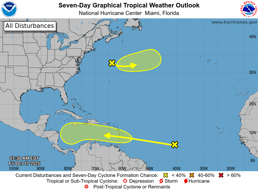
Let’s start with the southernmost blob on the National Hurricane Center’s forecast map, because that is of far more interest to pretty much all concerned. The forecasters at the hurricane center give this tropical wave a 30 percent chance of becoming a depression or tropical storm over the course of the next week as it moves westward, into the Caribbean Sea.
What we can say for sure is that the tropical system will bring a round of stormy activity, including heavy rainfall, to the Windward Islands this weekend. However we don’t expect tropical storm-force sustained winds or a significant storm surge. The question then becomes, what next? We of course don’t have any absolute answers for you. However, there is general agreement among most of our models that a low pressure system will be in the Central Caribbean Sea by around next Wednesday.
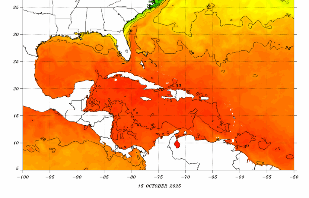
After this, well, we can’t really say much intelligent. There is potentially a corridor that could open to allow the tropical system to lift north during the middle of next week, toward Hispaniola or Puerto Rico. Alternatively, the system may just slowly meander westward in the Caribbean Sea (perhaps reaching Central America, and perhaps not) for a few days before finally moving north or northwest. I think the biggest point of concern I have is that, although we have reached mid-October, the Caribbean Sea remains plenty warm to support the development of a hurricane if other conditions are favorable. So we are going to keep a close eye on this one in the coming days.
Northern blob
This is non-tropical low pressure system that has a very slight chance of becoming an extra-tropical system during the next couple of days before reaching much colder water in the Northern Atlantic. Really, I think some forecaster at the hurricane center must have fancied the color yellow, and wanted to add a little more to the map, because this system is likely to be inconsequential.