Originally published at: Thursday was one of Houston’s most humid days on record – Space City Weather
In brief: After yesterday’s ridiculously high humidity in Houston and across southern Texas, we start to think about more rain chances this weekend. We’ll start to dry out a bit more next week, with a return of hotter weather and standard Houston mid-summer.
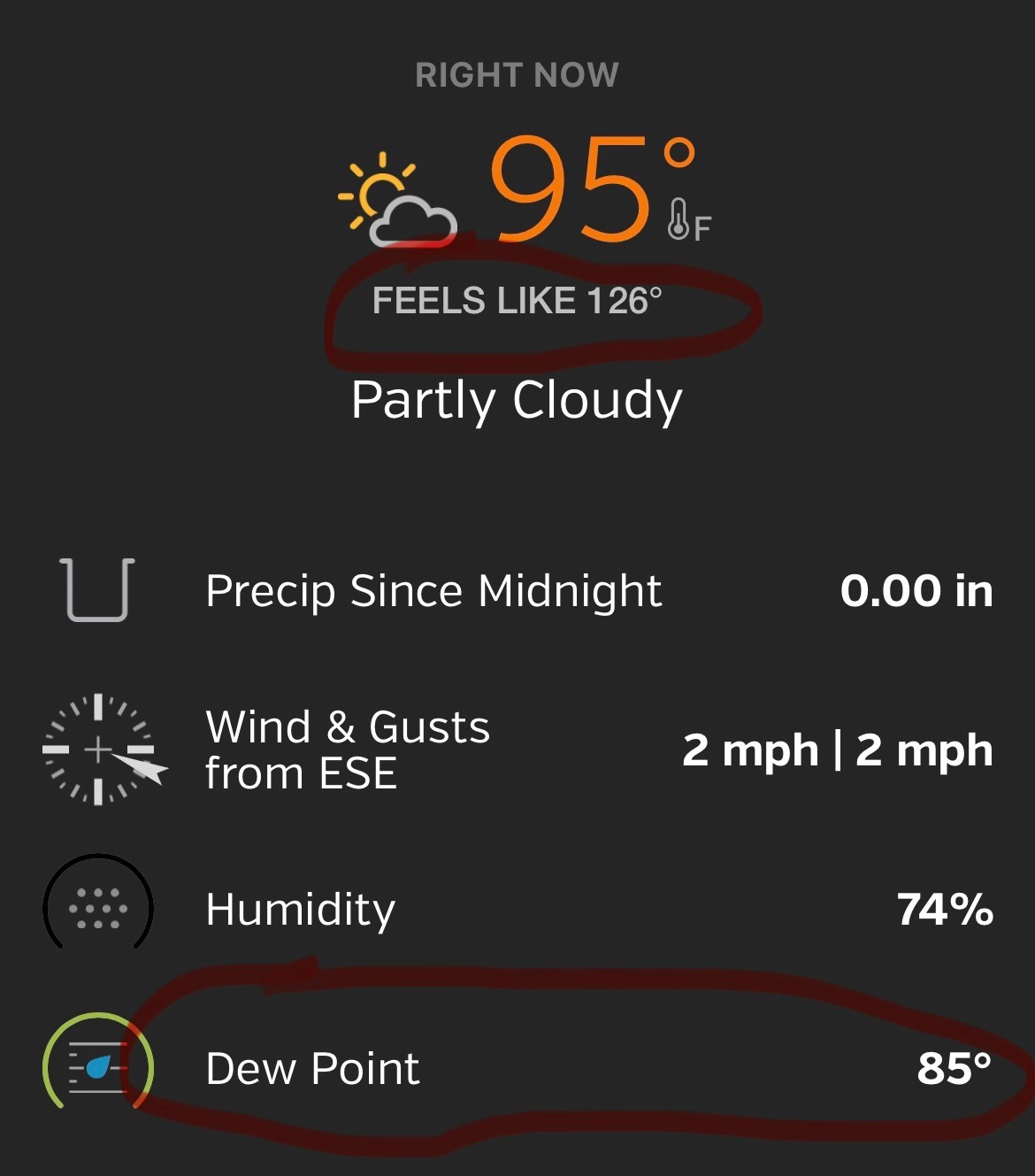
In the storied history of Texas humidity, yesterday was a first ballot hall of fame day. “But it’s always humid and hot in Texas.” Yes, that is the case from June through September. However, statistically, yesterday was on another level. Let’s start with Houston. I went back and looked at hourly observations from Bush Airport going back to the 1970s. Yesterday ended up being the 12th most humid day on record there. How am I defining “most humid?” It’s the daily average of dewpoints. The higher the dewpoint, the more humid or oppressive it is.
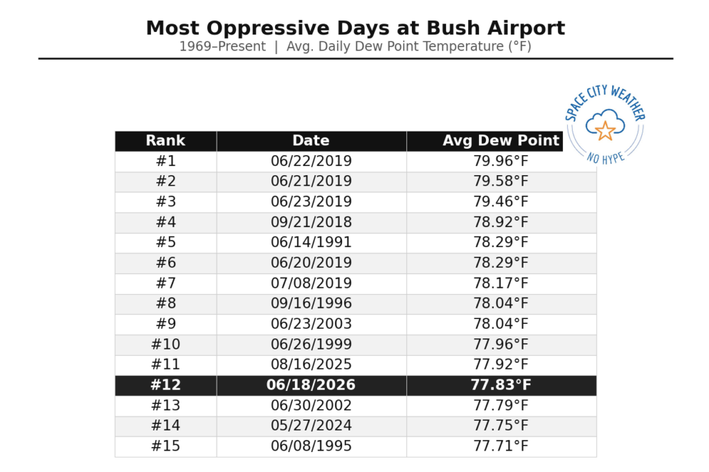
I was surprised to see that one day last summer (August 26th) actually beat it out by a tenth of a degree. The most miserable stretch of humidity on record in Houston had to be June 2019, with dewpoints averaging near 80 degrees.
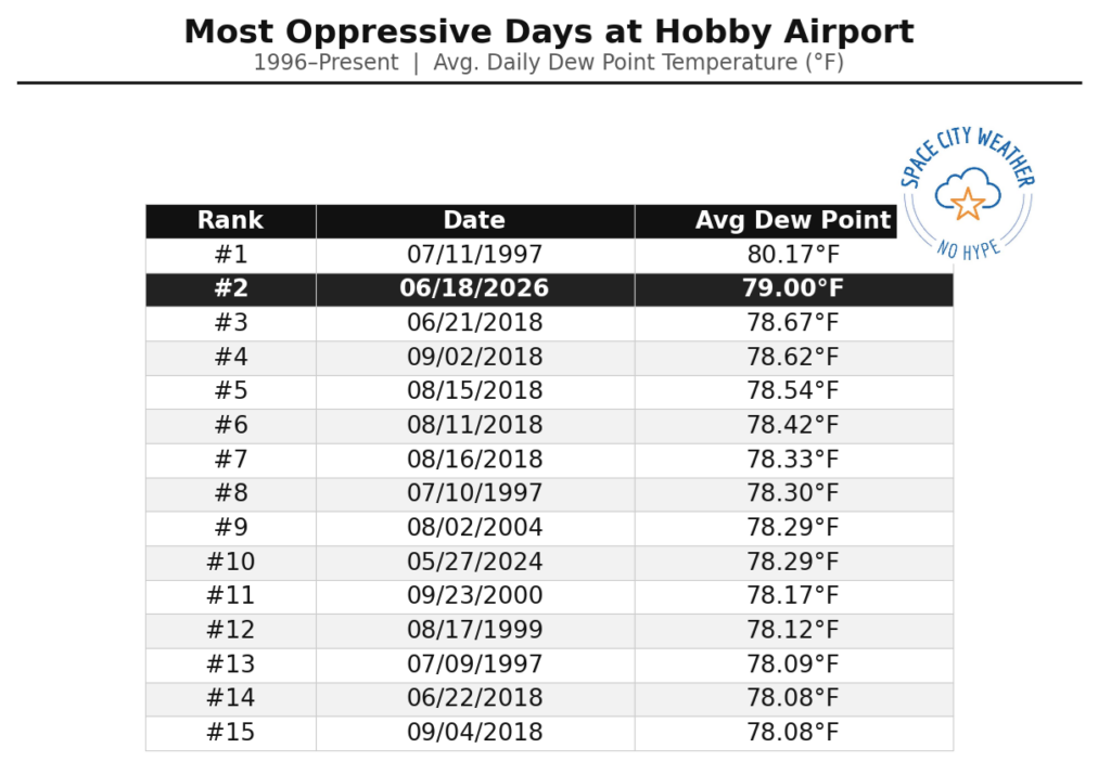
Now, if you change the location, you get some different results. For instance, at Hobby Airport (where hourly records only go back to 1996), it still ended up being the second most oppressive day on record.
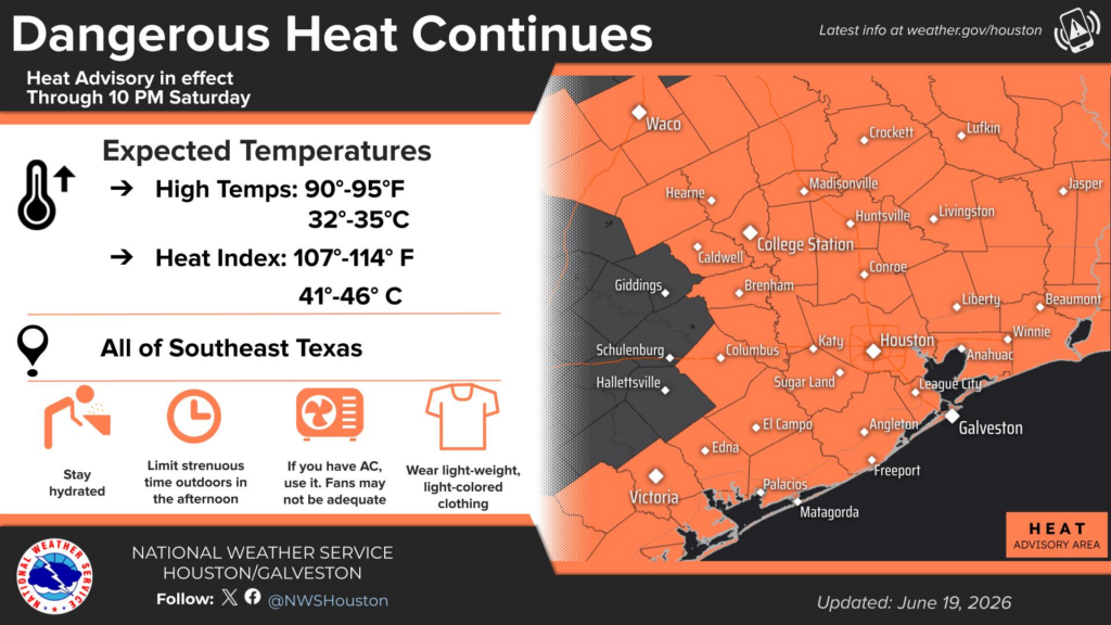
While actual air temperatures weren’t too crazy, the combination of this humidity, in some cases way inland also produced some extreme heat outcomes. Maximum heat index values hit 110° in Galveston and College Station, 112° in Waco, Tomball, and Sugar Land, 113° at Bush and in San Antonio, 114° at Hobby, 118° in Austin and Brownsville, 120° in Bay City, and 122° (not a typo) at Corpus Christi. That Corpus heat index has only been hit on seven prior occasions back to 1948. Their all-time record heat index is 125° on June 17, 2023.
So no, it was not your imagination; yesterday was near maximum tier humidity for the Houston area, and much of Texas for that matter. The cause obviously has something to do with Arthur and the recent surplus of rain we’ve received. But I am assuming it’s pretty nuanced, with some degree of those influences as well as a warm Gulf contributing. I think that the Arthur influence is tenuous, however. Typically, winds behind tropical systems come out of the north or northwest, which actually lowers the humidity a little but allows temperatures to skyrocket (dry air heats up more efficiently than humid air). Yesterday saw winds out of the south or south southeast. I have to think the warm Gulf and recent rains and saturated soil were the primary causes.
Onward.
Today
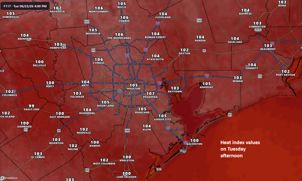
I wish I could tell you today would be a little less oppressive, but I cannot. At least not for the morning. Dewpoints remain in the upper 70s and low-80s across the area this morning. Thus, heat index values are already in the lower 90s in most spots. As the day goes on, we’ll probably see humidity values drop just a little, which is enough to keep us in Heat Advisory conditions today rather than yesterday’s Extreme Heat Warning. Heat index values will probably peak a couple degrees lower than on Thursday.
Additionally, we could see some rain today, which would help the heat out. Today’s higher rain chances are north of I-10, especially as you get up toward College Station, Conroe, or Lake Livingston. That said, we could see a few storms fire off in the Houston Metro as well. Any storm today could again produce torrential rainfall for a short period of time and localized street flooding.
Saturday
We should cool off a little more on Saturday thanks to some added cloud cover and rain chances. Saturday’s specific rain forecast is a little tricky, but scattered thunderstorms are likely across the entire area. This means not everyone will see rain, but many folks should. Yet again, locally heavy downpours are a possibility. Look for highs around 90 and heat index values probably another 1 to 4 degrees lower at peak than today.
Keep the heat in mind, especially if you’re participating in the Oranje Fanwalk for the World Cup or heading to the events in EaDo (and elsewhere).
Sunday
The end of the weekend should begin to transition us back to more typical summer weather. Look for isolated to scattered thunderstorms, with less coverage than Saturday. High temperatures will be in the low-90s with typical Houston heat index values in the low to mid 100s.
Next week
It would seem that next week will step us up into standard Mid-summer weather here in Houston. High temperatures each day should be in the low to mid-90s.
Morning lows will be generally around 80, give or take a couple degrees. And rain chances will be low but not zero.