Originally published at: Houston to face widespread rain showers this weekend, followed by a stronger front next week – Space City Weather
In brief: In today’s post we discuss rainfall amounts for this weekend, when we are likely to see our greatest totals in a quite some time. We also provide an update on our Fall Day celebration, and look ahead to a stronger front next week.
Eric, isn’t Fall Day on Saturday?
Yes, it is. Somehow, the “geniuses” who run Space City Weather scheduled Fall Day for Saturday October 25th, a day when the region has its best chance of widespread rain in quite literally months. The reality, of course, is that such events take a lot of planning (which Reliant has really been helping us with), including scheduling Midtown Park, ordering all sorts of things, and inviting a lot of different groups to come make the day special for everyone. So we selected October 25th earlier this summer.

So what are we going to do? For now we are still planning to hold Fall Day from 10 am to Noon CT on Saturday, pending the forecast. There remains a fair bit of uncertainty in the timing of the storms on Saturday (they could be pre-dawn, they could be mid-morning smack during Fall Day, or around noon or later). If the gathering poses any danger to people we are going to cancel it of course, but we want to wait a little while longer to make a final decision. Matt and I know better than anyone how forecasts can shift. Thanks for your interest and patience.
Wednesday
We should have held Fall Day today! It’s pleasant outside this morning, with fairly low humidity and temperatures in the 60s. With modest easterly winds throughout the day, humidity will remain low as high temperatures reach about 80 degrees beneath mostly sunny skies. Humidity levels will start to creep back up overnight, so although inland areas probably will drop into the upper 50s or lower 60s, coastal areas may well be a bit warmer late tonight.
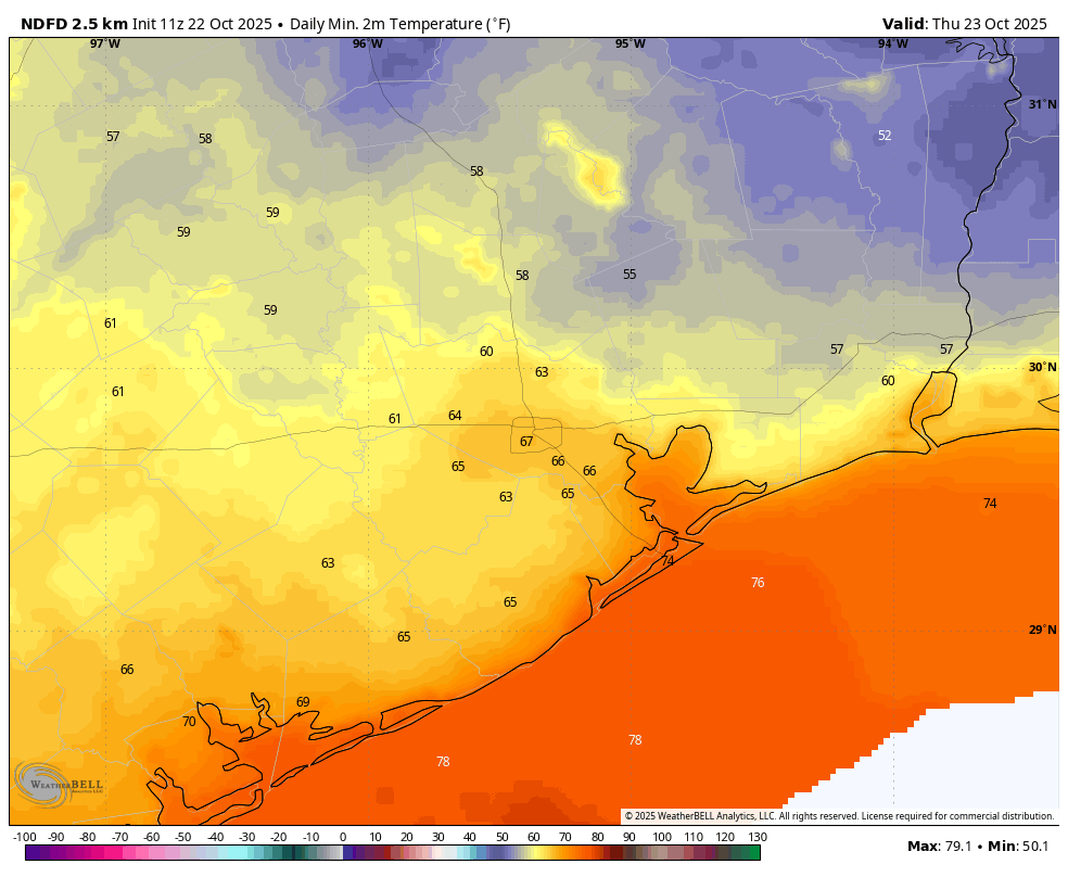
Thursday
As the onshore flow resumes we may see a few more clouds in the sky, and humidity will go up as well. Highs likely will crest in the mid-80s before a mild night with lows in the upper 60s to around 70 degrees. There is a slight chance of showers near the coast.
Friday and Saturday
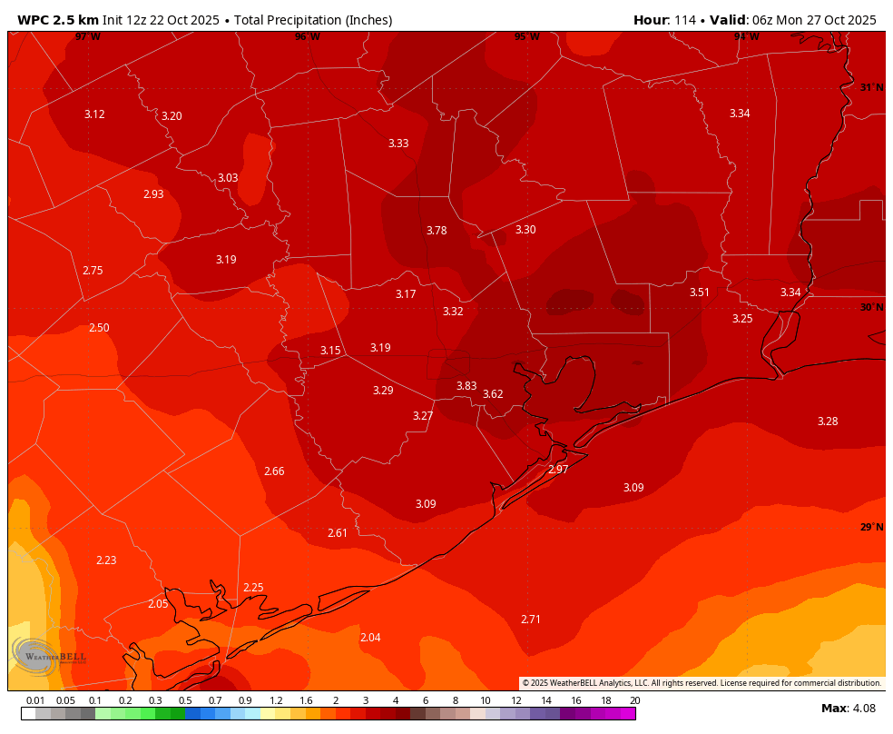
We should see some sunshine on Friday morning, but clouds will start to build later in the day. An upper-level low pressure system and an accompanying front at the surface will advance toward the area, and overall dynamics support the development of showers and thunderstorms to go along with it. The timing is our real point of uncertainty. Generally what I expect is scattered showers and thunderstorms on Friday afternoon and night (highs in the 80s on Friday). At some point a line of storms will push through the area along with the surface front, but whether that happens earlier Saturday or later in the day, we just don’t know yet. But at some point we’re going to see moderate to heavy rainfall. Although totals will vary widely, most of the region should pick up 1 to 4 inches. We hope to have better details about all of this for you in tomorrow’s forecast update, when we begin to have improved high resolution data. Anyway, highs on Saturday will likely be in the 70s (at least we got that part of Fall Day correct, hah).
Sunday
Rain chances won’t go away during the second half of the weekend, but they should be decidedly lower than Saturday. Expect a high near 80 degrees, with overnight lows in the 60s.
Next week
The first half of next week will probably see highs in the low- to mid-80s with muggier air before a stronger front arrives (Wednesday, maybe?) The details of this are still pretty fuzzy, but we can almost assuredly expect to see some much drier and colder air.
