Originally published at: While Tropical Depression 2 lurks in the Gulf, we currently expect minimal impacts in Houston – Space City Weather
In brief: Tropical Depression 2 may become a tropical storm later today or tomorrow, but for Houston at this point we are not expecting significant impacts, anticipating that it will fall apart before arriving here. Still, we encourage folks to monitor the forecast over the next couple days in case anything should change. Otherwise, heat is the story this week, with a legitimate shot at 100 degrees, especially Wednesday.
Tropical Depression 2
Let’s get right down to business.
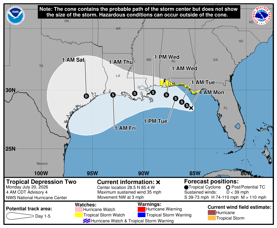
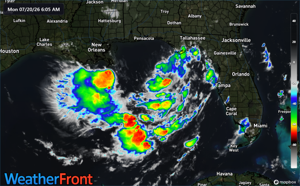
Tropical Depression 2 formed yesterday in the eastern Gulf. Over the next couple days, it’s expected to drift westward, becoming a tropical storm. Now, I’ll be the first to tell you that looking at this thing on satellite this morning, it’s not exactly looking healthy.
And, in fact, the vast majority of tropical modeling, as well as Google Deep Mind’s 1,000 member forecast ensemble keep TD 2’s intensity at or below middle grade tropical storm levels. In other words, we do not believe this is going to be a repeat of Beryl. Interestingly, if you look at the various ensembles, you also see a lot of them “losing” Tropical Depression 2 before it gets to Texas.
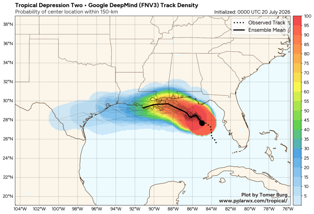
In other words, we are seeing the bulk of the modeling say that TD 2 is going to run its course before getting to Texas. The 5 to 10 percent or so that survive west of Louisiana are the ones coming to Texas. So it may look as if the modeling is all pointed right at Texas, but in reality, that’s mainly saying the remnant is. And when you look at the NHC forecast at the top, you’ll notice the intensity is dropped to depression when it makes it to Texas. Frankly, that may be generous given what we see this morning. It may be that this system ends up arriving as a shell of itself in Texas.
There are still a handful of model ensembles that track the system a little farther south, a scenario we won’t take off the table. But in those cases, it’s likely that the intensity of TD 2, or Bertha, would be capped by wind shear. And if that doesn’t do it, dry air that surrounds this thing on all sides probably will.
So what does it mean here in Houston?
As of today, impacts are expected to be minimal. Wind impacts at this point would be tropical depression or less. Marine impacts would be for some minor coastal flooding perhaps or just slightly higher tides. And rainfall impacts would also be minimal, with just a slightly increased chance of showers on Thursday or Friday perhaps.
That’s as of right this moment. Forecasts can and do change, and we encourage you to continue monitoring the forecast as the week progresses. If something notable changes this afternoon, we’ll chime in later today.
Hottest week of summer
Meanwhile, truthfully, the bigger story this week will be the heat. This is going to be our hottest week of summer so far. We have our best chance at 100 degrees beginning tomorrow and perhaps more likely on Wednesday.
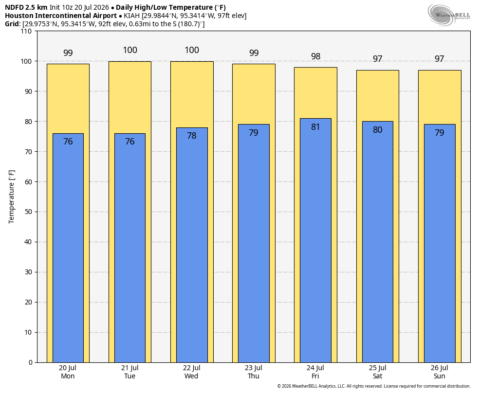
We encourage folks to try not to go out exercising during the peak heat of the day, drink water, and just keep in mind that while your body adapts to summer heat, some days are just a little bit worse than others. That’s Tuesday and especially Wednesday. On the flip side, the humidity doesn’t look overly impressive. In fact, because of Tropical Depression 2, Houston may actually see some drier air filter in out of the northeast. That won’t make it feel gloriously comfortable, but it may allow for heat index values (or “real feel” temperatures) to be somewhat tolerable. It may also mean the difference between a heat advisory instead of an extreme heat warning.
After Friday
As noted earlier, the remnants of TD 2 could provide a slight bump in shower chances Thursday or Friday. After that, it looks like very standard summer here. We’ll probably have a couple thunderstorms each day but nothing significant. Temperatures will be hot but not extreme. And barring any change in pattern, it should be fairly calm.

