Originally published at: Showers and thunderstorms possible in Houston region today and this evening – Space City Weather
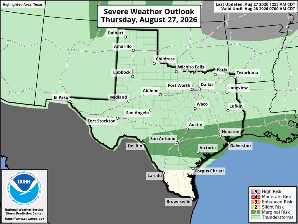
In brief: We actually have some dynamic weather to talk about in today’s forecast! Due to a boundary moving in, the region will see some shower and thunderstorm chances. The most likely time frame for this is Thursday afternoon north of the city, and the evening hours in Houston and closer to the coast.
Rain, actually
It has been a long, hot, and mostly dry August but some real change is on the way. It’s still going to be sizzling today, with temperatures in the upper 90s. But after today most of the region will fall back into the mid-90s for awhile. And thanks to a stalling boundary, we are going to see a healthy chance of rain showers today in the greater Houston area. Not everyone is going to see showers or thunderstorms, but overall chances are probably on the order of 50 percent, which represents our highest likelihood of rain in weeks.
Thursday
With a check of the radar just before sunrise, we can see shower activity developing north of the Houston region, in areas such as College Station and Livingston. These showers should progress into Montgomery County over the next hour or two before stalling out. I don’t think they will get all the way to Harris County, at least for the most part.
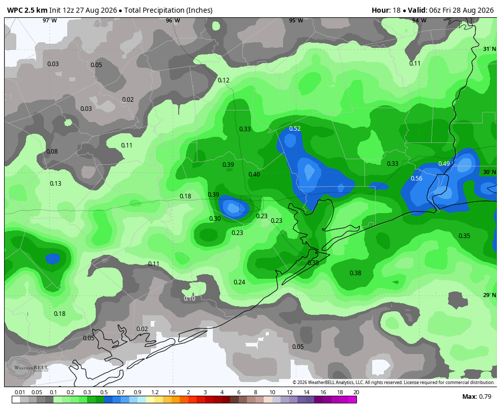
We will see sunny skies during the middle of the day, and very hot conditions like we’ve experienced so far this week. However we should see another round of showers and thunderstorms this afternoon, possibly initiating north of Interstate 10 and then moving down toward the coast through the evening hours. This time frame represents when most of the region should see its best chance of rainfall. Accumulations will vary widely, from no rain to some bullseyes of 1 or more inches. Showers should subside by or before midnight.
Friday
We should see a few more clouds on Friday, limiting highs to the low- to mid-90s. Rain chances will be lower, possibly in the 20 to 30 percent range.
Saturday and Sunday
The weekend should bring mostly sunny and (for late August) temperate conditions. Expect highs in the low- to mid-90s. The likelihood of rain showers is not zero, but it’s close. Overall this should be a pretty nice weekend for outdoor activities involving water.
Next week
At this point we should see a summer-like pattern next week, with high temperatures mostly in the mid-90s and a low-end potential for daily showers along the sea breeze. These are typical conditions for early September here.



