Originally published at: Dry and hot for awhile now in Houston as high pressure takes control – Space City Weather
In brief: After a pair of almost fall-like weather days, Houston’s pattern will tilt back toward summer. As high pressure asserts control our forecast looks to be locked in for pretty much the next 10 days: hot days, lots of sunshine, and virtually no chance of rain.
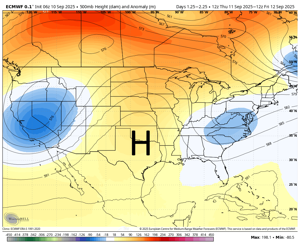
High pressure in September
When it comes to weather, most people understand that low pressure equates to the potential for stormy conditions, whereas high pressure creates a more stable atmosphere with sinking air. At most times of year when we see high pressure (sinking air) this leads to mostly sunny or cloudless days. This can feel fantastic in February or March, but decidedly sultry and hot in July and August.
By the middle of September we are starting to edge toward fall, with shorter days and a lower Sun angle, high pressure hits a little bit different. Instead of high temperatures of 100 degrees like in August, we are likely to see highs generally in the mid-90s. Instead of lows around 80 degrees, we are likely to see low- to mid-70s. Dewpoints should be 5 to 10 degrees lower which means the air will feel slightly less humid than peak summer.
So for those who want a little bit more summer, you’re in luck. For those pining for fall after the last couple of days, it’s going to be a loooong week, at least.
Wednesday
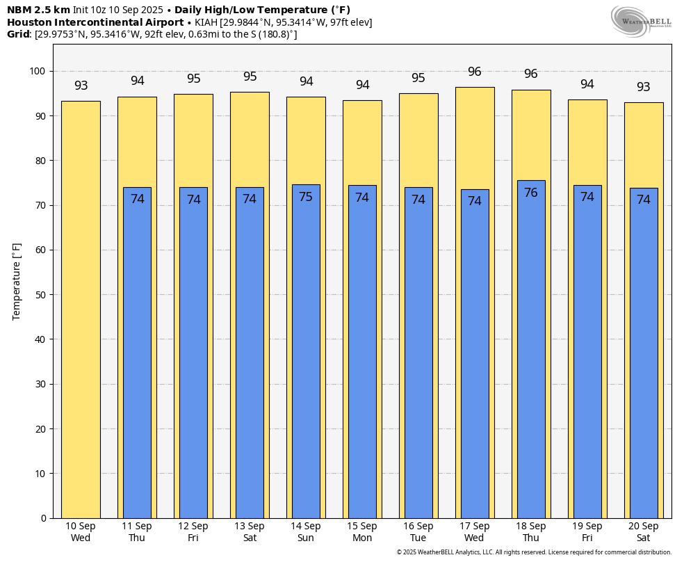
It is another pleasantly cool morning across the region, with the usual spots such as Conroe dipping into the upper 50s and much of Houston in the mid-60s this morning. Alas, all good things must end. Winds will turn easterly today, increasing an onshore flow, and starting to increase humidity levels. For the most part I think highs today will remain in the low- to mid-90s, with sunny skies. Lows tonight will only drop into the mid-70s, so about 10 degrees warmer for most locations. With light winds today, conditions are favorable for producing elevated levels of ozone. An Ozone Action Day is in effect.
Thursday through Sunday
Each of these days is going to be very, very similar. We can expect mostly sunny to cloudless days with highs in the low 90s near the coast and mid-90s for most of the rest of the area. Some far inland locations may push into the upper 90s. Most days will have modest southeasterly winds at about 10 mph. Nights will be in the mid-70s. Rain chances will be essentially zero. If you have outdoor plans our confidence in this forecast is very high.
Next week
Not much changes for at least the first half of next week: same skies, same temperatures, similar humidity. Rain chances are low through at least Wednesday or Thursday, by which time coastal areas may start to see some isolated showers. Really, I don’t see any real spark of change in this pattern until at least next weekend, and maybe not then.
Atlantic tropics
Today is the historical peak of the Atlantic hurricane season. Yet this year, there is precisely nothing to talk about. That is ideal!
